

Oregon Unit 52 Topo Maps Hunting & Unit Maps
Sold out

Oregon Unit 52 Topo Maps Hunting & Unit Maps
Currently there are 20 peoples are currently looking at this product
Spend $1,000.00 for FREE SHIPPING
Description
Customer Review
Be the first to review “Oregon Unit 52 Topo Maps Hunting & Unit Maps” Cancel reply
Click Here to View Large Map or Order
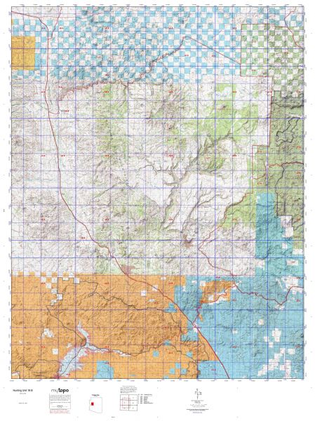
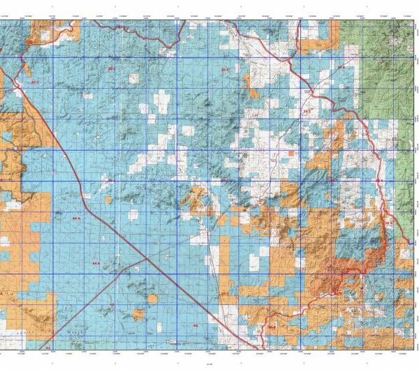
Oregon Unit 52 hunting map topo with printed boundaries
HuntersDomain has Oregon unit 52 hunt area maps that are 1:100,000-scale maps using Bureau of Land Management land status base maps.
Our UNIT 52 maps include:
- Oregon public land ownership boundaries
- Topographical contour lines
- 1:100,000 scale for easy viewing
- Roads printed
- Key terrain features to help you plan your hunt or trip
- Hunt area or game management unit 52 (GMU 52) boundary is overlaid on the BLM base map
- Easy planning for your upcoming big game hunt by defining roads and routes into the preferred area
Custom maps for unit 52 are also available (See it all on one map):
- Color aerial photo maps: high resolution (you define borders/boundaries)
- TOPO maps only where you easily define borders or edges of maps with our online program
- Hybrid maps: a unique and detailed aerial photo combined with a USGS topographical maps (user-defined boundaries)
Order your unit 52 Oregon topo map today!
The actual boundary description/definitions printed below from the Oregon Division of Wildlife hunting regulations brochure could have errors or been amended by the state so always check in their most current printed regulations or the Oregon Division of Wildlife website to verify these boundaries before hunting as these are for reference only.
– (Moffat) bounded on N, East, and South by Green River; on West by Utah.
Click Here to Order Unit 52 Topo Map
Unit description
STARKEY 67% of public lands. Beginning on Interstate-84 at State Highway 82 at La Grande; southeast on Interstate-84 to North Powder; west on N Powder River Ln to Ellis Road; south on Ellis Road to Anthony Lks Road; west on Anthony Lks Road 73 to Anthony Lks; west past Anthony Lks to Granite-Ukiah Road 52; northwest on Granite-Ukiah Road 52 to Tower Mount Road 5226; east and north on Tower Mount Road 5226 past Tower Mount and Frazier Forest Camp to State Highway 244 (Forest Road 59); east on Highway 244 (Forest Road 59) to Forest Road 5900230 at Four Corners Forest Camp; north on Road 5900230 to 2100040, north on Road 2100040 to Forest Road 21; north on 21 to Forest Road 2135; northeast on 2135 to Forest Road 2135400; northeast on Forest Road 2135400 to Kamela; east on Summilet Road to Interstate-84; southeast on Interstate-84 to Highway 82, point of beginning. (Maps: Wallowa-Whitman National Forest, Vale Bureau of Land Management, Oregon Department of Forestry)


Reviews
There are no reviews yet.