Nevada Hunting Unit 211 Topo Maps 

Nevada Hunting Unit 211 Topo Maps 

Currently there are 20 peoples are currently looking at this product

Spend $1,000.00 for FREE SHIPPING

Description
Customer Review

Reviews

There are no reviews yet.

Be the first to review “Nevada Hunting Unit 211 Topo Maps ”

Your email address will not be published. Required fields are marked *

Click Here to View Large Map or Order

Nevada Unit 211 hunting map topo with printed boundaries

HuntersDomain has Nevada unit 211 hunt area maps that are 1:100,000-scale maps using Bureau of Land Management land status base maps.

Our UNIT 211 maps include:

  1. Nevada public land ownership boundaries
  2. Topographical contour lines
  3. 1:100,000 scale for easy viewing
  4. Roads printed
  5. Key terrain features to help you plan your hunt or trip
  6. Hunt area or game management unit 211 (GMU 211) boundary is overlaid on the BLM base map
  7. Easy planning for your upcoming big game hunt by defining roads and routes into the preferred area

Custom maps for unit 211 are also available (See it all on one map):

  1. Color aerial photo maps: high resolution (you define borders/boundaries)
  2. TOPO maps only where you easily define borders or edges of maps with our online program
  3. Hybrid maps: a unique and detailed aerial photo combined with a USGS topographical maps (user-defined boundaries)

Order your unit 211 Nevada topo map today!

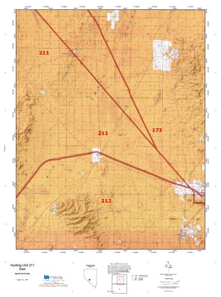
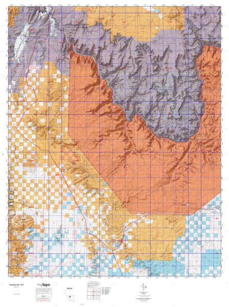
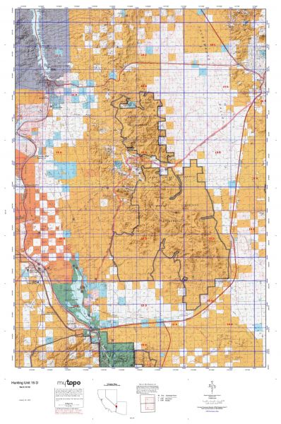
The actual boundary description/definitions printed below from the Nevada Division of Wildlife hunting regulations brochure could have errors or been amended by the state so always check in their most current printed regulations or the Nevada Division of Wildlife website to verify these boundaries before hunting as these are for reference only.

Nevada Big Game Unit 211

– Unit 211 Topo/Map Nevada – Game Management Unit (GMU-211).

Game Management Unit (GMU)

BLM Maps:

Reservation Land

US Forest Service Maps:

Reservation land

Click Here to Order Unit 211 Topo Map

Unit description

Unit 211: That portion of Esmeralda County west of the Silver Peak to Oasis Pole Line Road, west of state Route No. 265, and north of U.S. Highway No. 95/6.


Shopping cart
Sign in

No account yet?

Start typing to see products you are looking for.
Shop
0 Wishlist
0 items Cart
My account