Click Here to View Large Map or to Purchase
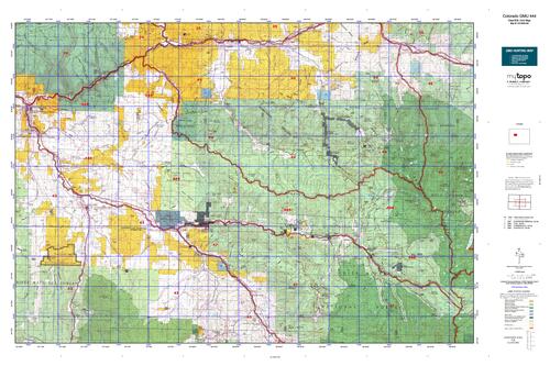
Colorado Unit 444 Hunting Topo Map with Printed Boundaries
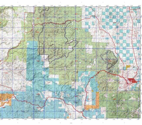
Hunters Domain has Colorado Unit 444 hunt area maps that are 1:100,000-scale maps using Bureau of Land Management land status base maps.
Our UNIT 444 maps include:
Colorado public land ownership boundaries
Topographical contour lines
1:100,000 scale for easy viewing
Roads printed
Key terrain features to help you plan your hunt or trip
Hunt area or game management unit 444 (GMU 444) boundary is overlaid on the BLM base map
Easy planning for your upcoming big game hunt by defining roads and routes into the preferred area
Custom maps for Unit 444 are also available (See it all on one map):
Color aerial photo maps: high resolution (you define borders/boundaries)
TOPO maps only where you easily define borders or edges of maps with our online program
Hybrid maps: a unique and detailed aerial photo combined with a USGS topographical maps (user-defined boundaries)
Order your Colorado Unit 444 Map Today!
The actual boundary description/definitions printed below from Colorado Parks and Wildlife hunting regulations brochure could have errors or been amended by the state so always check in their most current printed regulations or the Colorado Parks and Wildlife website to verify these boundaries before hunting as these are for reference only.
Colorado Big Game Unit 444
– Unit 444 Topo/Map Colorado – Game Management Unit (GMU-444).
Game Management Unit (GMU)
BLM Maps:
Reservation Land
US Forest Service Maps:
Reservation land
Click Here to Order Your Color Colorado Unit 444 Hunting Map
Colorado Unit 444 Description
Unit 444 Located in Garfield, Pitkin and Eagle Counties bounded on the North by the Colorado River, Cottonwood Creek, Eagle CR 10A (Cottonwood Pass Rd.), USFS 514 (Red Table Mountain Rd.) and Fryingpan-Eagle River divide; on the East by divide between Lime Creek and North Fork of Fryingpan River and its tributaries and Cross Creek-Homestake Creek drainages; on the South by Ivanhoe Creek and Fryingpan River; on the West by Roaring Fork River.
GMU 444 This area encompasses the Roaring Fork, Frying Pan and Crystal River drainages. The lower elevations (6500’) are primarily developed or agricultural. Timberline is around 11,500’ and there are 14,000’ peaks in the Wilderness Areas. Be prepared for daytime highs of 75F dropping to 20F at night. Snow can exceed several feet in the higher elevations and moisture can make roads dangerous or impassible. 4WD is a necessity. There are large blocks of private lands in the western part of GMU 444.This herd is concentrated in aspen and oakbrush habitats before the snow flies. Hunting pressure does not generally cause herd movement, but they will move to lower elevation woodlands as snow accumulates. Archery and muzzleloader hunters should head to timberline. Early rifle season hunters should focus on high elevation areas around timberline, Capitol Creek, Haystack Mountain and East Snowmass Creek. Later season hunters could try “The Crown”, Holgate Mesa, Williams Hill and Light Hill, but expect to see other hunters in these areas. Some good bucks can be found if hunters focus in areas away from roads. Early seasons find elk anywhere from 7500’ to above timberline. With increased hunting pressure and snow, herds tend to move to remote areas or private lands – away from roads and hunters. The wilderness areas are a good bet for success but hunters must hike or horseback as motorized travel is prohibited. Try Snowmass Creek, Conundrum Creek, Capitol Creek, Avalanche Creek, Difficult Creek, McFarland Creek, Maroon Creek, Thompson Creek, Basalt Mountain, Four-mile, the Marble area, and the upper Frying Pan drainages. Kobey Park and Sloans Peak are good but deep snow and bad roads should be expected, especially later in the seasons.


Reviews
There are no reviews yet.