Click Here to View Large Map or to Purchase
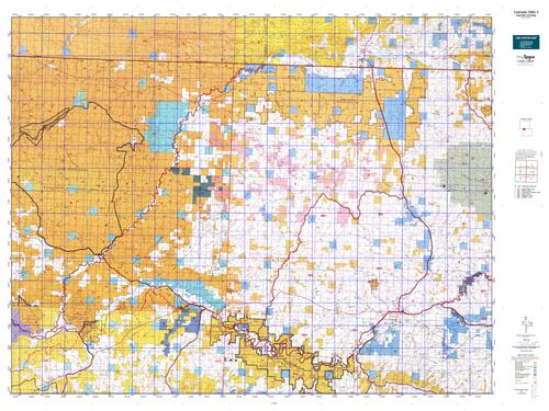
Colorado Unit 3 Hunting Topo Map with Printed Boundaries
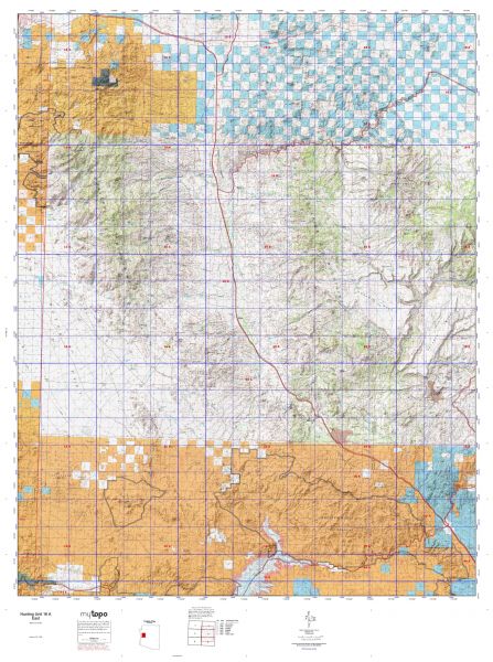
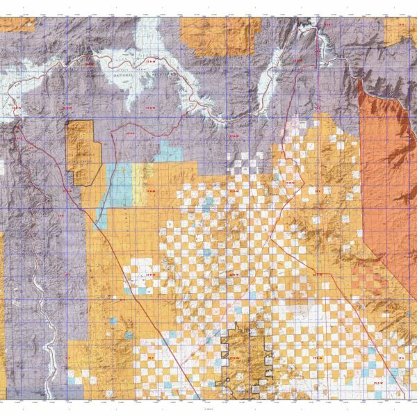
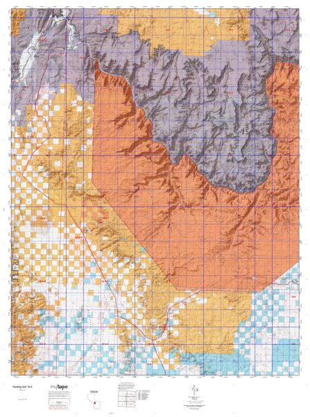
Hunters Domain has Colorado Unit 3 hunt area maps that are 1:100,000-scale maps using Bureau of Land Management land status base maps.
Our UNIT 3 maps include:
Colorado public land ownership boundaries
Topographical contour lines
1:100,000 scale for easy viewing
Roads printed
Key terrain features to help you plan your hunt or trip
Hunt area or game management unit 3 (GMU 3) boundary is overlaid on the BLM base map
Easy planning for your upcoming big game hunt by defining roads and routes into the preferred area
Custom maps for Unit 3 are also available (See it all on one map):
Color aerial photo maps: high resolution (you define borders/boundaries)
TOPO maps only where you easily define borders or edges of maps with our online program
Hybrid maps: a unique and detailed aerial photo combined with a USGS topographical maps (user-defined boundaries)
Order your Colorado Unit 3 Map Today!
The actual boundary description/definitions printed below from Colorado Parks and Wildlife hunting regulations brochure could have errors or been amended by the state so always check in their most current printed regulations or the Colorado Parks and Wildlife website to verify these boundaries before hunting as these are for reference only.
Colorado Big Game Unit 3
– Unit 3 Topo/Map Colorado – Game Management Unit (GMU-3).
Game Management Unit (GMU)
BLM Maps:
Reservation Land
US Forest Service Maps:
Reservation land
Click Here to Order Your Color Colorado Unit 3 Topo Map
Colorado Unit 3 Description
Unit 3 Located in Moffat County bounded on the Noth by Wyoming; on the East by Colorado Hwy 13/789 and CRs 108, 3, 5 & 17; on the South by the Yampa River, U.S. 40 and Colorado Hwy 318; on the West by the Little Snake River.
GMU 3 The lower elevations of 6,000 ft consist of sage and sage steppe. Pinyon and juniper cover the upper elevations up to 8,500 ft. Expect zero to light snow cover in 1st & 2nd seasons. The later seasons may bring moderate snow and a potential for near zero temperatures. If the weather is mild, deer and elk will not be present in high numbers until the later seasons. Overall access is easy and 4WD is not necessary in most areas. Hunting pressure is heavy. About 70 percent of the Lower Yampa is public land. The mid-range elevations with mountain shrub and pinyon-juniper breaks generally hold the most deer, especially during the regular rifle seasons. Movement occurs with weather and hunting pressure. Large elk herd occupies all available habitat. The later seasons are usually better, especially on public land, due to snow and hunting pressure pushing the elk out of the adjacent units. The success rate is very good on late cow elk hunts. The best Bull Elk hunting will be on private lands.


Reviews
There are no reviews yet.