Oregon Unit 67 Topo Maps Hunting & Unit Maps

Oregon Unit 67 Topo Maps Hunting & Unit Maps

Currently there are 20 peoples are currently looking at this product

Spend $1,000.00 for FREE SHIPPING

Description
Customer Review

Reviews

There are no reviews yet.

Be the first to review “Oregon Unit 67 Topo Maps Hunting & Unit Maps”

Your email address will not be published. Required fields are marked *

Click Here to View Large Map or Order

Oregon Unit 67 hunting map topo with printed boundaries

HuntersDomain has Oregon unit 67 hunt area maps that are 1:100,000-scale maps using Bureau of Land Management land status base maps.

Our UNIT 67 maps include:

  1. Oregon public land ownership boundaries
  2. Topographical contour lines
  3. 1:100,000 scale for easy viewing
  4. Roads printed
  5. Key terrain features to help you plan your hunt or trip
  6. Hunt area or game management unit 67 (GMU 67) boundary is overlaid on the BLM base map
  7. Easy planning for your upcoming big game hunt by defining roads and routes into the preferred area

Custom maps for unit 67 are also available (See it all on one map):

  1. Color aerial photo maps: high resolution (you define borders/boundaries)
  2. TOPO maps only where you easily define borders or edges of maps with our online program
  3. Hybrid maps: a unique and detailed aerial photo combined with a USGS topographical maps (user-defined boundaries)

Order your unit 67 Oregon topo map today!

The actual boundary description/definitions printed below from the Oregon Division of Wildlife hunting regulations brochure could have errors or been amended by the state so always check in their most current printed regulations or the Oregon Division of Wildlife website to verify these boundaries before hunting as these are for reference only.

Oregon Big Game

– (Moffat) bounded on N, East, and South by Green River; on West by Utah.

Click Here to Order Unit 67 Topo Map

Unit description

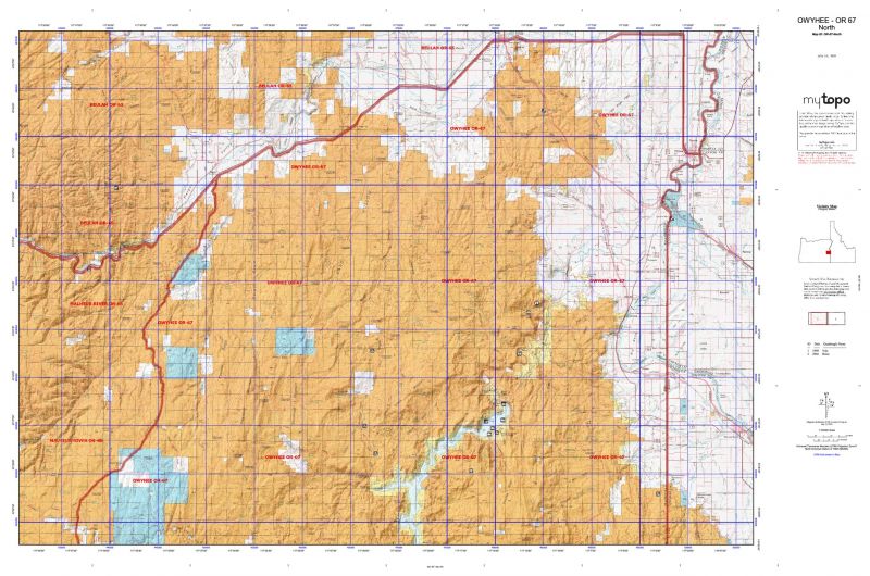
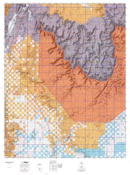
OWYHEE 82% of public lands. Beginning at Nyssa; south on Oregon-Idaho state line to Jordan Valley-Silver City Road; west on Jordan Valley-Silver City Road to Jordan Valley; southwest on United States Highway 95 to State Highway 78; northwest on Highway 78 to Follyfarm; northeast on Follyfarm-Harper Road to Harper; east on United States Highway 20 to Cairo Junction, south on Highway 20/26 to Nyssa, point of beginning. (Maps: Vale Bureau of Land Management)


Shopping cart
Sign in

No account yet?

Start typing to see products you are looking for.
Shop
0 Wishlist
0 items Cart
My account