Oregon Unit 30 Topo Maps Hunting & Unit Maps

Oregon Unit 30 Topo Maps Hunting & Unit Maps

Currently there are 20 peoples are currently looking at this product

Spend $1,000.00 for FREE SHIPPING

Description
Customer Review

Reviews

There are no reviews yet.

Be the first to review “Oregon Unit 30 Topo Maps Hunting & Unit Maps”

Your email address will not be published. Required fields are marked *

Click Here to View Large Map or Order

Oregon Unit 30 hunting map topo with printed boundaries

HuntersDomain has Oregon unit 30 hunt area maps that are 1:100,000-scale maps using Bureau of Land Management land status base maps.

Our UNIT 30 maps include:

  1. Oregon public land ownership boundaries
  2. Topographical contour lines
  3. 1:100,000 scale for easy viewing
  4. Roads printed
  5. Key terrain features to help you plan your hunt or trip
  6. Hunt area or game management unit 30 (GMU 30) boundary is overlaid on the BLM base map
  7. Easy planning for your upcoming big game hunt by defining roads and routes into the preferred area

Custom maps for unit 30 are also available (See it all on one map):

  1. Color aerial photo maps: high resolution (you define borders/boundaries)
  2. TOPO maps only where you easily define borders or edges of maps with our online program
  3. Hybrid maps: a unique and detailed aerial photo combined with a USGS topographical maps (user-defined boundaries)

Order your unit 30 Oregon topo map today!

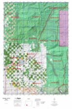
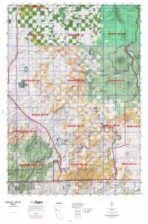
The actual boundary description/definitions printed below from the Oregon Division of Wildlife hunting regulations brochure could have errors or been amended by the state so always check in their most current printed regulations or the Oregon Division of Wildlife website to verify these boundaries before hunting as these are for reference only.

Oregon Big Game

– (Moffat) bounded on N, East, and South by Green River; on West by Utah.

Click Here to Order Unit 30 Topo Map

Unit description

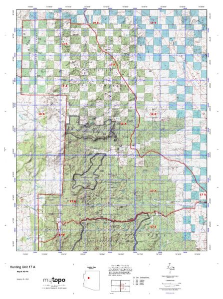
Rogue 57% public lands. Beginning at Medford; north on State Highway 62 to State Highway 230; northeast on Highway 230 to State Highway 138; south and east on Highway 138 to Pacific Crest Trail; south on Pacific Crest Trail to the boundary of Crater Lk NP; west, south, and east on Crater Lk NP boundary to Pacific Crest Trail; south on Pacific Crest Trail; southeast on Forest Trail 993 along Fourmilele Lk; south on Forest Road 3661 to State Highway 140; west on Highway 140 to Forest Road 3601; south on 3601 to Dead Indian Road; southwest on Dead Indian Road to Jackson- Klamath Company line; south on Jackson- Klamath Company line to State Highway 66; west on Highway 66 to Copco Road; south on Copco Road to Oregon-California state line; west on state line to Interstate-5; north on Interstate-5 to Medford, point of beginning. (Maps: Rogue National Forest, Medford Bureau of Land Management)


Shopping cart
Sign in

No account yet?

Start typing to see products you are looking for.
Shop
0 Wishlist
0 items Cart
My account