Nevada Hunting Unit 252 Topo Maps

Nevada Hunting Unit 252 Topo Maps

Currently there are 20 peoples are currently looking at this product

Spend $1,000.00 for FREE SHIPPING

Description
Customer Review

Reviews

There are no reviews yet.

Be the first to review “Nevada Hunting Unit 252 Topo Maps”

Your email address will not be published. Required fields are marked *

Click Here to View Large Map or Order

Nevada Unit 252 hunting map topo with printed boundaries

HuntersDomain has Nevada unit 252 hunt area maps that are 1:100,000-scale maps using Bureau of Land Management land status base maps.

Our UNIT 252 maps include:

  1. Nevada public land ownership boundaries
  2. Topographical contour lines
  3. 1:100,000 scale for easy viewing
  4. Roads printed
  5. Key terrain features to help you plan your hunt or trip
  6. Hunt area or game management unit 252 (GMU 252) boundary is overlaid on the BLM base map
  7. Easy planning for your upcoming big game hunt by defining roads and routes into the preferred area

Custom maps for unit 252 are also available (See it all on one map):

  1. Color aerial photo maps: high resolution (you define borders/boundaries)
  2. TOPO maps only where you easily define borders or edges of maps with our online program
  3. Hybrid maps: a unique and detailed aerial photo combined with a USGS topographical maps (user-defined boundaries)

Order your unit 252 Nevada topo map today!

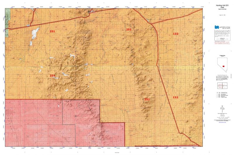
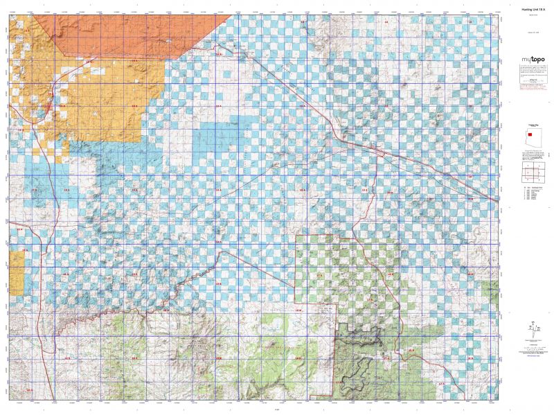
The actual boundary description/definitions printed below from the Nevada Division of Wildlife hunting regulations brochure could have errors or been amended by the state so always check in their most current printed regulations or the Nevada Division of Wildlife website to verify these boundaries before hunting as these are for reference only.

Nevada Big Game Unit 252

– Unit 252 Topo/Map Nevada – Game Management Unit (GMU-252).

Game Management Unit (GMU)

BLM Maps:

Reservation Land

US Forest Service Maps:

Reservation land

Click Here to Order Unit 252 Topo Map

Unit description

Unit 252: That portion of Nye County outside the Nellis Air Force Range, bounded on the north by the Stonewall Flat Road, on the south by the road that begins at its intersection with U.S. Highway No. 95 approximately 1.6 miles north of Springdale and travels northeast approximately 5.25 miles to the boundary of the Nellis Air Force Range, and by the access road to the Death Valley National Park that begins at its intersection with U.S. Highway No. 95 approximately 1.6 miles north of Springdale and runs southwest approximately 7 miles to a point approximately 0.6 miles west of the northeast corner line of the Death Valley National Park and then by the north boundary line of the Death Valley National Park , and those portions of the Nellis Air Force Range as authorized by the United States Department of Defense.


Shopping cart
Sign in

No account yet?

Start typing to see products you are looking for.
Shop
0 Wishlist
0 items Cart
My account